Ohio Ag Net | Ohio's Country Journal Ohio Ag Net | Ohio's Country Journal

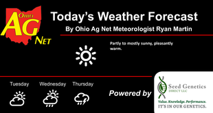
Very warm and very humid this week. That airmass will set us up for some instability. The first part of the week we see a continuation of the set up from this past weekend…very active to the north over WI and MI, with some of that action trying to drift south into north central and NW Ohio. Therefore, we cant rule out a few scattered showers today and tomorrow north of US 30. However, generally we see very little precipitation . Thunderstorms become more likely Thursday into Friday. But even there, the best set up resides a bit farther west. So, this week we have potential for about 60% coverage on moisture, but rain totals generally under half an inch. The rest of the holiday weekend is precipitation free. The map below shows combined rain potential from today through Labor Day.

The rest of next week remains very warm and humid. We do not have any well organized precipitation threats through next Thursday. However, for next Friday we finally have a strong front developing to the NW. This front sweeps through late Friday bringing a bit of shower and thunderstorm action. Rain totals come in at .25″-1″ on 75% coverage. We do have cooler air working in behind that front for the weekend of the 12th and 13th, staying for the start of the following week.